The world is pretty big. It is also covered in roads. How do you choose which to cycle? Finding a route is actually quite easy once you start to break it down. Does the weather affect choices? What about visa constraints? Is that area safe? What are the road elevations? How busy will it be? What towns do you want to visit?
If someone has taken the time to map out a long-distance bike route I usually reckon it’s worth riding. Sometimes you can even get accompanying guide books for them. You can find lots of those routes online on sites such as Eurovelo (Europe) or Adventure Cycling (USA). I like reading other cycle blogs for ideas on routes and I also love the website Dangerous Roads for inspiration.
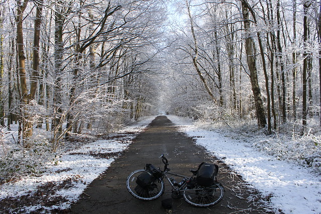
Once I have a rough idea of the route I want to head in I break things down in a little more detail with an online mapping website. There are a bunch of sites that do a similar thing but the one I’ve always used is Ride With GPS. You input an A and B destination and it will recommend a cycling route, showing you the distance and elevation chart. Both are as important: a short 50km day with 1,5000m ascent will be more exhausting than a 100km day with only 500m ascent. I usually ride around 80-100km a day but it depends on so many factors; road condition, elevation, wind etc. I’ve spent an entire day covering only 25km on a rocky mountain road, but I’ve also covered 185km in the same amount of time on a flat sealed road with a tailwind behind me.
Once I’ve chosen a route sometimes I export the .gpx file onto my Garmin Edge 200 (I’m not a fan of this device but it does the job) and then I have a nice neat line to follow. This way I don’t have to worry about checking the map all the time and I can concentrate on taking it easy in the saddle.
I don’t always do this. It’s nice to have an overview but you need internet and time. Often I just go with the flow and hope for the best. Sometimes it’s worse knowing which mountains are coming up but it’s often nice to know you haven’t picked the toughest pass!

Here’s a summary on my route with some thoughts on my choices between the UK and Australia. (Hindsight is a bitch when you’re cycle touring).
Europe
I loosely followed the National Route 1 From London to Dover. Sustrans have a network of long-distance cycle routes mapped out in the UK.
Once over The English Channel I followed the North Sea Cycle Route (Eurovelo 12) towards Denmark. (Eurovelo have a fantastic network of routes across Europe that are worth checking out). It wasn’t that exciting but only because that part of Europe is pancake flat. Countries like Holland and Germany are heaven for cyclists – special bike lanes are entirely separate from main roads in much of the country.
Heading south from Denmark I loosely traced the Copenhagen-Berlin trail. The sections through the forests of Brandenburg were gorgeous – I’d certainly recommend that route.
From Berlin I joined up a couple of different German cycle routes between Berlin-Leipzig and Dresden around the Flaeming-Skate network.
Back on the Eurovelo 4 (Central Europe Route) along the Elbe was a lovely ride, as were the sections of the Greenways Prague-Vienna route I pedalled.
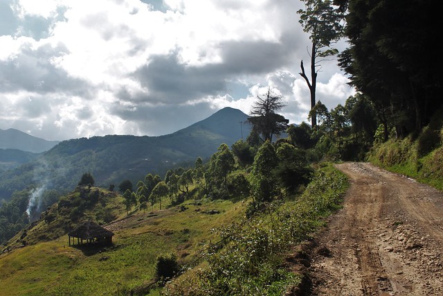
From Slovakia I began to loosely trace the Eurovelo 13 (Iron Curtain Trail) along the former Iron Curtain. It had only been part realised at the time I cycled it. The section along the Danube between Serbia and Romania was one of my favourite roads in Europe and the mountain roads along Macedonia and Bulgaria were sensational.
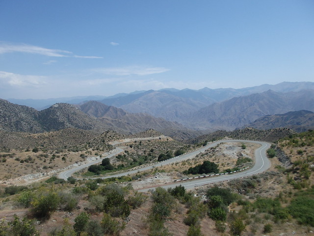
Turkey & The Caucuses
I made a few bad decisions on my route across Turkey. I was chasing a visa so I wasted time cycling fast along the main roads between Istanbul, Ankara and Samsun. It would have been far nicer to follow the coastal road between Istanbul and Samsun, rather than head in land. Cycling into Istanbul itself is one of the most awful experiences you will have on two wheels… what a slog!
The coastal road from Samsun to Georgia is popular among touring cyclists. God knows why. It is scenic, but far too busy and very repetitive. I’d recommend heading into the hills for beauty and cut up north just before the border.
From Batumi in Georgia the road up to Goderdzi pass is very beautiful (if a workout)! I don’t think any roads in that country are not pretty and I would have loved to cycle more in the north.
In Armenia there aren’t that many roads to choose from and I would recommend the route I took to Iran. The ‘scenic’ road to Yerevan (see my map) is a much nicer alternative to the capital than the main road down from Lake Yerevan.
There are two roads leading down to the border. The eastern one was fantastic. Very new when I rode it with great road quality and little traffic. I would recommend sticking east all the way down.
Iran & Central Asia
Do not follow the main road if you are heading to Tabriz. The minor road that leads up and over the mountains is a beautiful two-day ride.
From Tabriz I followed the main road all the way east to Turkmenistan. If I wanted to make detours, I’d have needed more than the month on my visa. It was uninspiring and busy but the Iranians made it far from boring.
You will probably need to stop by Tehran for onward visas, making it convenient to stay south of the mountains dividing the sea and Tabriz-Tehran-Mashhad road. I have not heard many good things about the coastal road and in holiday season it is very busy.
With only 5 days to cross Turkmenistan on a transit visa you do not have much choice with roads. The dirt road ‘shortcut’ from the border (you’ll find it on the map) is ride-able, although I didn’t take it.
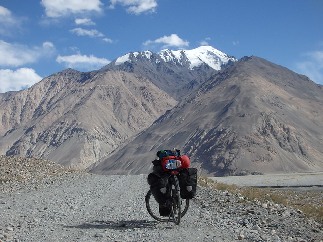
If you are in this part of the world you should be cycling the Pamir Highway. From Dushanbe be sure to take the northern route East. It’s a rough road but very scenic and you don’t have the trucks to deal with.
Whichever way you ride out of Khorog will be beautiful. I cycled along the Wakhan corridor which was stunning but Khargush pass was a serious ordeal. I would recommend the Wakhan detour, although I’m certain sticking to the M41 would still be great.
The main road between Osh and Bishkek in Kyrgyzstan is narrow and occasionally busy. Traffic reduces after the first day heading north. It’s a beautiful road but I’m certain it’s not as magical as the route further east. The only problem is that the eastern tracks are really rough and it will take you twice the time to get anywhere. Sadly I didn’t have the time to spare when I was there. Winter was coming…
If you are not interested in Almaty, then the route to Kazakhstan via lake Issyk Kul would probably be more scenic. The steppes north of the border are rather uninspiring after all those mountains.
China
Welcome back to the desert! I spent weeks on the miserable G30 motorway, racing to get past winter and save time on my visa.
You have two main choices up there. The G30 across the Gobi or the Taklamakan desert road. I hated the G30 – it was a motorway with fences separating you from the desert along every inch. The Taklamakan road is not like this but apparently the traffic is worse as there is no hard shoulder. Chinese truck drivers are not a fun bunch to share the roads with, believe me.
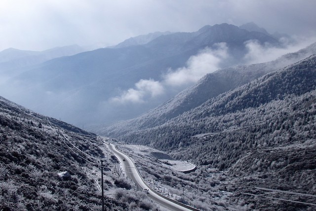
I would recommend heading into Qinghai and up onto the Tibetan Plateau as soon as possible. Check the current situation – in 2015 there were many roads off-limits to foreigners.
China only became interesting once I had climbed up onto the plateau (started ascending near Lanzhou). From there everything was gorgeous. If you are coming from Central Asia I would recommend keeping as far west as possible and high up in the mountains. Hopefully you are there at a sensible time of year – I was up there in December and it was freezing!
The G318 From Chengdu to Lhasas is the main road connecting Tibet with the rest of the country. You’d think the road would be far too busy as a result but actually it was a fantastic ride up into the mountains. As a foreigner you’ll have to turn south before the province border. I turned off at Litang and the western road from there to Shangri-La was absolutely sensational.
Another highlight in China was riding along the Dulong Valley alongside the Mekong. The river has now been damned meaning that the old road that I cycled will be underwater but the new road cut up into the mountains will still be beautiful. Perhaps even more so as you have greater views from up there.
The rest of Yunnan was a pleasure to cycle. Only the main road from Lincang to Pu’er was disappointing but from there the minor road in the mountains alongside the border is gorgeous and visiting Yuanyang’s famous rice terraces it’s definitely worth the detour.
South East Asia
The route I followed across Northern Vietnam and Laos was lovely riding. The minor dirt roads up in Laos are seriously hard work. The gradients are much more punishing in SE Asia than in China!
The main road from Chiang Khong to Chiang Mai was unpleasant and busy but heading up and over the mountains from there to the Myanmar border was beautiful. That road is one for the hill lovers though – your legs will be burning after those impossibly steep sections!
If you are heading south through Myanmar you don’t have much choice with roads. The road is now sealed all the way to the bottom and you should be able to travel the full distance (it was out-of-bounds to tourists until recently). There were a few scenic sections but overall it was not a thrilling ride. Most of it was steep hills through endless palm oil plantations.
The eastern side of Malaysia would be better for cycling. I stuck to the populated West Coast because I needed to get a visa in Penang. Had I not needed the paperwork I’d have skipped Georgetown, Kuala Lumper and Malacca in favour of the Eastern side.
Indonesia is a big country. If you have two months then Sumatra to Timor is a lot to ask of your legs. Check the route I cycled – that took me two months but it was a rush. In hindsight, if I had the same amount of time I would have taken the boat to Jakarta from Singapore and skipped Sumatra. The Eastern half of Indonesia was more beautiful and far less crowded. Sumatra and Java are hell for cycling. Sumatra would be great on the minor roads but don’t bother with the island if you are going to stick to main roads. Java is a slog wherever you head. Wonderful people but the most dangerous roads I have ever traveled.
Sumbawa was my favourite island, do not skip that. The Trans-Flores highway is probably the most beautiful road I cycled in Indonesia but hard work. That first pass leaving Labuanbajo… Killer!
From Kupang the main road to the East Timor border is dull in comparison with Flores but once you are over the border things change dramatically. East Timor was a stunning place to cycle. The road along the south coast is in dreadful condition and off-limits in rainy season but a real adventure I promise!
Australia
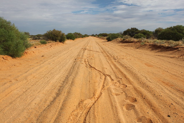
I had no idea it would be possible to cycle straight through the middle of the country, right across the outback. It is.
I’d planned on riding east from Darwin to Townsville via the Savannah Way which would have been a challenging ride. Wet season was around the corner when I arrived in the country and I wasn’t convinced it would be safe/possible getting over those river crossings.
Instead I rode straight down the Aussie centre. The Stuart Highway is an easy cycle. There are rarely any gaps of more than 100km between roadhouses and it’s easy to cover good ground on the asphalt. (Bare in mind you will have a lot of headwind crossing the country in my direction!)
If you are going to tackle the outback I suggest you do it properly. Get off the bitumen and onto the dirt to experience the real emptiness. The Meerenie Loop (Red Centre Way) was a brilliant ride to Uluru (Ayre’s Rock) via Kings Canyon and the Oodnadatta Track was my favourite road in Oz. You need to be prepared though; at times you will need water for more than 200km and days’ worth of food.
The landscape finally changes once you reach the Flinders Ranges down in South Australia. That is a very beautiful part of the country and you can follow the Mawson Trail the last few hundred miles to Adelaide (the website Cycle Trails Australia is a great resource for cycle touring in Oz!). I rode a couple days of it and would recommend if you have the time (it adds on a lot of distance between the mountains and Adelaide).
There are some nice stretches along the coast towards Melbourne, the highlight being the tourist’s favourite The Great Ocean Road leading into the capital.
That’s all for now, folks!
